Published 17:22 IST, January 10th 2020
Comparison between images from ISRO's Cartosat-3 with other satellites; see pictures
ISRO releases the first images from Cartosat-3 covering Qatar. Here is a comparison between images taken by Cartosat-3 along with Google, Bing and Apple Maps.

On Friday, ISRO released the first images from Cartosat-3 covering the entire region of Qatar. The high-resolution images covered three main areas of Qatar-- The Khalifa International Stadium, Palm City Gardens 2 and the Old Doha Airport. Cartosat-3 satellite is a third-generation agile advanced satellite having high-resolution imaging capability.
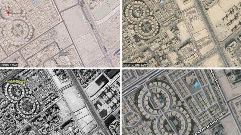
Here is a comparison between images taken by Cartosat-3 along with Google Maps, Bing Maps and Apple Maps-
The above image is of Palm City Gardens-2 in Qatar. The resolution of the image by Cartosat-3 far exceeds the resolution of images by Google, Apple, and Bing Maps.
The next image is of the Khalifa International Stadium in Qatar. As one can see, the resolution of the image by Cartosat-3 is the clearest in terms of color and contrast. It also shows better details and a finer street view as well.
The last set of images are of the Old Doha Airport in Qatar. The Google maps image shows an outdated 2019 version. Bing Maps has a more clear view. The Apple Map could not be zoomed in any further. The images by Cartosat-3 was the clearest of them all.
About the Cartosat-3
The satellite was placed in an orbit of 509 km at an inclination of 97.5 degrees. PSLV-C47 also carried 13 commercial nanosatellites from the United States of America as part of a commercial arrangement with NewSpace India Limited (NSIL), Department of Space. PSLV-C47 is the 21st flight of PSLV in the 'XL' configuration (with 6 solid strap-on motors). ISRO has said, this was the 74th launch vehicle mission from SDSC SHAR, Sriharikota.
Updated 17:23 IST, January 10th 2020


