Published 19:45 IST, January 26th 2022
ESA's Mars Express beams back 'geologically rich' image from Mars; know all about it
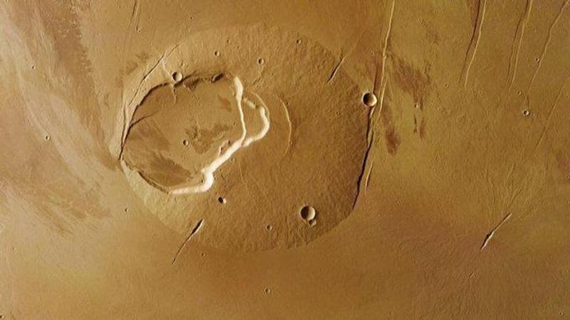
According to ESA, this image was captured on May 13 and June 2 and clearly featured lava flows all over the visible Martian plane.

The European Space Agency's (ESA) Mars Express spacecraft has snapped what the agency calls is a 'geologically rich' picture featuring the Jovis Tholus shield volcano on Mars. Lying in the shadows of the Solar System’s largest volcano, Olympus Mons, Jovis Tholus has a long eruptive history, as per the agency. While the volcano does not seem large enough, its caldera system comprises at least five craters with the largest being 28 kilometres wide.
According to ESA, this image was captured on May 13 and June 2 and clearly features lava flows all over the visible Martian plane. Another picture shared by the agency features a 30km wide impact crater on the plain to the north of the Jovis Tholus.
What makes the area geographically rich?
The above two individual images are actually part of a single picture sent by the Mars Express. In the first one, ESA explains the geography by pointing out visible lava flows across the region whereas, in the second image, it highlights the crater created when an asteroid or comet crashed on Mars.
(Colour coded topography of Jovis Tholus; Image: ESA)
In this single image posted above, the red portion represents the bulged part of a less developed volcano whereas the blue part represents the asteroid-hit area. According to the agency, the asteroid must have hit water or ice-saturated region as the evidence hint toward its watery past. ESA says that the top left of the image shows signs of an outflow channel which likely formed from the water bursting out in the region. "Massive amounts of water were likely purged from underground aquifers over time as a result of volcanic warming melting the ground ice, and as faulting took place, with the water taking the easiest way to the surface through the graben system", ESA said in a report.
The imaging was made possible thanks to the Mars Express, which has been orbiting Mars since 2003 and has gathered data over the red planet's minerals, its atmosphere, the Martian crust and how the solar wind interacts with the red planet's atmosphere.
Image: Twitter/@ESA
Updated 19:45 IST, January 26th 2022


