Published 12:47 IST, July 5th 2020
NASA releases pic of several environmental wonders of Pacific Northwest taken from ISS
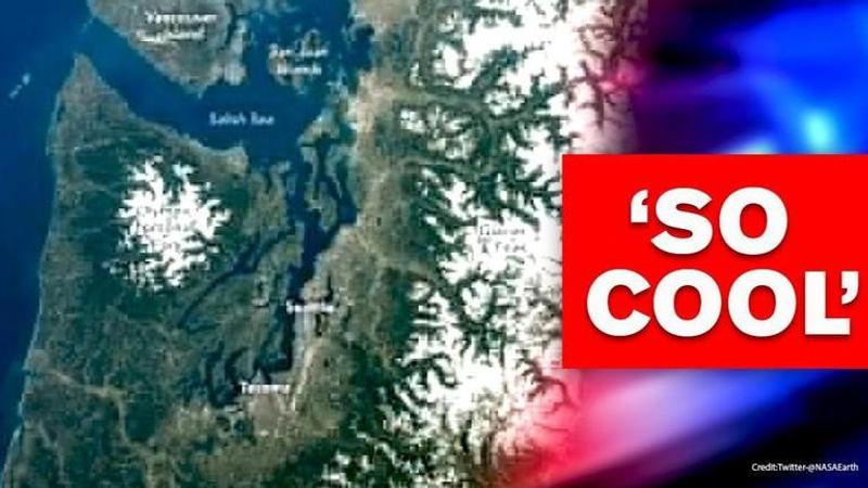
NASA Earth shared the photo of the Pacific Northwest of the United States taken from ISS showing the Cascade Mountains, Olympic Peninsula, and the Salish Sea.

An astronaut’s experience of the topography and environmental wonders from the International Space Station (ISS) has intrigued the internet. On July 4, NASA Earth shared the photo of the Pacific Northwest of the United States taken from ISS showing the Cascade Mountains, Olympic Peninsula, and the Salish Sea that caught the eye of the astronaut during his spacewalk. Running across the southern British Columbia in Canada through Washington, Oregon, and Northern California in the US, the rugged terrain masked by the snow was shot in mid-April 2020.
According to the report released by NASA, the iconic photograph was captured on Nikon D5 digital camera using a 50-millimeter lens and is provided by the ISS Crew Earth Observations Facility and the Earth Science and Remote Sensing Unit, Johnson Space Centre. It broadly depicted the popular Olympic National Park that occupied the center of the Olympic Peninsula in northwestern Washington. The park is renowned to have been explored by some of the prominent figures in history such as naturalist John Muir, nicknamed as “The Father of the National Parks” in the late 1800s, and President Franklin D. Roosevelt who had initially declared the region as a park in 1938. Glaciated peaks of the Olympic Mountain Range abound in the ecosystem with the temperate rainforests were viewed from the space and was captured in the photograph.
Image taken by Expedition 62 crew
Another environmental landscape of ecological significance, the Salish Sea whose islands were declared as a national monument by President Barack Obama in 2013 were also seen from the ISS. With several waterways, including the Strait of Georgia, the Strait of Juan de Fuca, and Puget Sound, the sea is famous for its archipelago, San Juan Islands which home to diverse species, according to NASA. The photograph captured by a member of the Expedition 62 crew showed a green and white combination of the terrain and the water bodies. The picture, which has been enhanced to improve contrast is “of the greatest value to scientists and the public”, according to NASA. The Internet poured a slew of reactions on the image.
Updated 12:47 IST, July 5th 2020


