Published 21:23 IST, June 22nd 2020
NASA observes huge Saharan Dust Plume over Atlantic Ocean heading to US
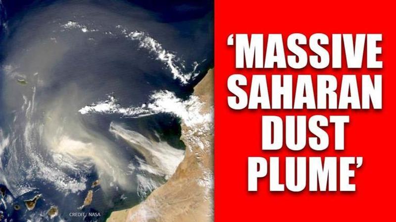
Visible on satellite imagery, brown sheen of Saharan Dust is fast spreading on African coast and is so dense that it blurs the visible lines between continents.

A massive drift of the Saharan dust plume is making a journey of more than 5,000-miles in northern Africa across the tropical Atlantic Ocean to the United States. Visible on the satellite imagery, the brown sheen is fast spreading off the African coast and is so dense that it blurs the visible lines between the continent and the ocean. According to NASA’s published report and the weather journal, the dust from the Sahara Desert has surged into the Caribbean Sea and it's expected to reach the Gulf of Mexico and parts of the United States this week.
According to NOAA's Hurricane Research Division (HRD), this dry dust plume commonly forms from late spring through early fall and moves into the tropical Atlantic Ocean every three to five days and is known as the Saharan Air Layer (SAL). As one of the densest and the stronger plumes, it formed and emerged off western Africa only last weekend and is expected to covering an area larger than the contiguous United States and western Europe.
“The Saharan Air Layer is typically located between 5,000 and 20,000 feet above the Earth's surface. It is transported westward by bursts of strong winds and tropical waves located in the central and western Atlantic Ocean at altitudes between 6,500 and 14,500 feet,” the NOAA's HRD wrote in a release on the website.
NASA released the forecast as a GEOS-5 model showing the dust plume that continues plowing westward through the Caribbean Sea. As per the National Weather Service in Houston, the Saharan dust combined with extremely high pressure could suppress thunderstorm chances near parts of the Gulf Coast coming week, however, rainfall could lead to some light amounts of dust on surfaces. Poor air quality is another possible impact as plumes might result in worse air quality categorized as "unhealthy" as per reports.
Cyclone development intensity not known
According to NOAA, “SAL is most common during hurricane season, research has been done on how it can affect the development of tropical storms and hurricanes.” While the dry air can create downdrafts (sinking air) around tropical storms and hurricanes, the NOAA said in the report that strong winds can lead to tropical cyclone development with its intensity not known. Here are the pictures of the dust plume development as shown in the NASA satellite imagery.
(All Images Credit: NASA)
Updated 21:23 IST, June 22nd 2020


