Published 19:52 IST, May 28th 2020
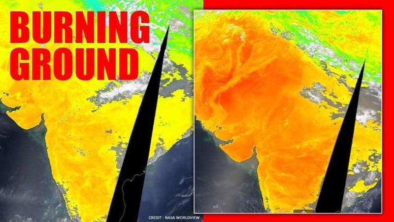
NASA satellite images from Worldview show heatwave impact in northern India
Large parts of Northern India has been witnessing extreme heatwave condition for the past few days after an unusual start to the summer with scattered rains.

Large parts of Northern India have been witnessing extreme heatwave condition for the past few days after an unusual start to the summer with scattered rains. The Indian Meteorological Department (IMD) warned of severe heatwave conditions on May 23 in the plains of northwest India and adjoining Central India which has been duly felt over the week.
Satellite images provided by NASA’s Worldview, an open-source project launched by the US space agency, gave a glimpse of the ongoing extreme heatwaves in India. The images for May 27, with a land temperature of around 52-degree celsius near Delhi during the daytime, are in stark contrast with the earlier images of April when the ground temperature was around 31-degree celsius near the same region.
Different from air temperature
However, the land temperature differs from the air temperature as the feature provides the temperature of whatever is covering the earth surface which could range from bare sand in the desert, ice and snow-covered area, a leaf-covered tree canopy and even the temperature of man-made buildings and roads.
“Land Surface Temperature is useful for monitoring changes in weather and climate patterns and used in agriculture to allow farmers to evaluate water requirements for wheat, or determine frost damage in orange groves,” says the Worldview website.
The open-source platform NASA's Earth Observing System Data and Information System (EOSDIS) provides the capability to interactively browse over 900 global, full-resolution satellite imagery layers. The layers are related to drought, fires, ash plumes, dust storms, air quality, floods, smoke plumes, severe storms, and vegetation among others.
Above image is from March 1 when the maximum temperature remained around 27-degree celsius.
While the maximum temperature showed a significant increase, it still remained moderate in north India as visible from above image from April 1.
This is the latest image from May 27 when several pockets of north India is going through severe heatwave condition.
The IMD has predicted respite from the heatwave from May 29 onwards in Delhi and other north Indian states with dust storm, thunderstorm and light rains in the coming days.
Updated 19:52 IST, May 28th 2020


