Published 19:24 IST, November 24th 2021
Seismologists prepare the first-ever map of Mars' underground layers using NASA's probe
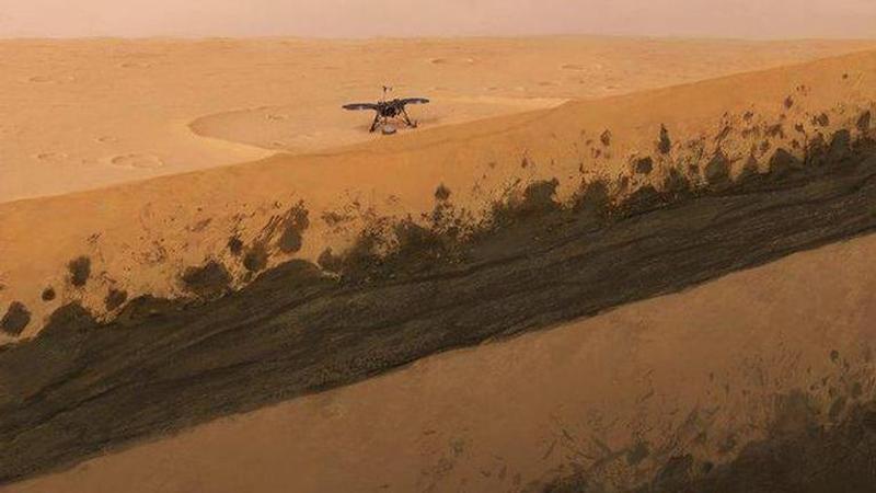
Seismologists from ETH in Zurich have created the first-ever map of Mars’ underground layers within the first 660 feet of its crust, using NASA's Insight probe.

Mapping the Earth’s subsurface just became obsolete as seismologists have created the first-ever map of Mars’ underground layers within the first 660 feet (200 meters) of its crust. The map was created by a team of researchers from the Swiss Federal Institute of Technology (ETH) in Zurich using the sound of winds that created vibrations near the equator of Mars.
In an interview with Space.com, Cedric Schmelzbach, a geophysicist at the ETH said-
We used a technique that was developed here on Earth to characterize places for earthquake risk and to study the subsurface structure. The technique is based on ambient vibration. On Earth, you have the oceans, the winds, that make the ground shake all the time, and the shaking that you measure at a certain point has an imprint of the subsurface.
Making measurements on Earth is easy since the vibrations can be detected clearly, winds are stronger owing to a thick atmosphere and there are numerous sensitive instruments available to do the job. However, Mars offers a completely different environment as there are no oceans to create vibrations, winds are extremely weak and the scientists relied on just one instrument. The researchers reportedly used the instruments of the Insight Probe, which landed in 2018, on the Elysium Planitia region of Mars.
Here’s what was found under Mars’ surface
According to the seismologists, the interaction of winds on Mars with its craters exposed the planet’s subsurface in intense detail as they found a layer of deep sediments and solidified lava shrouded with a 10-foot-thick blanket of sandy regolith. Moreover, the sedimentary layer, which came as a surprise to the experts, is sandwiched between two layers made of ancient lava some 100 to 230 feet underneath the surface. The scientists estimated that the two layers date back to somewhere between 1.7 billion and 3.6 billion years ago and above the younger layer is a 50-feet-thick band of materials made of rocks. Talking about the surprising sedimentary layer, Schmelzbach said as per Space.com-
We're still working on how to interpret that and how to date how old this layer is. But it tells us that probably the geological history at that site is really more complicated than we originally thought and that probably more processes had happened in the past at that place.
Image: Twitter/@ETH
Updated 19:24 IST, November 24th 2021


