Published 23:28 IST, January 12th 2024
Intense 7.6 Earthquake shifts Japan's Noto Peninsula Coastline by 800 Feet, Satellite Images Show
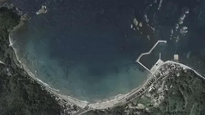
The satellite image of the shift in the coastal line of Japan's Noto Peninsula was shared on X by Nahel Belgherze.

The powerful 7.6 magnitude earthquake that jolted struck Japan on Jan. 1 around 2:10 a.m. EST was so intense that it shifted the coastline of Japan's Noto Peninsula by 800 feet. Satellite images captured show the changes in the coastline due to the massive earthquake on New Year's Day on the island country.
The satellite image of the shift in the coastal line of Japan's Noto Peninsula was shared on X by Nahel Belgherze, an Electronics Technician from France. The photo depicts that the seafloor has risen above the water, and has formed a new beach. The coastline changes can be prominently seen on the image after the tsunami and quake hit. Some of the ports have been rendered completely dry and inaccessible to boats, reports suggest.
The earthquake that struck Japan’s Noto peninsula on Monday was so strong that the coastline has moved up to 250 meters offshore due to significant land uplift. pic.twitter.com/XpxBMLRTUU
— Nahel Belgherze (@WxNB_) January 4, 2024
An intense shift of the coastline by up to 820 feet (250 meters)
The before and after Satellite imagery shows the intense shift of the coastline by up to 820 feet (250 meters). This is much larger than the length of two American football fields. As a result of the quake, the harbours has run completely dry. “The earthquake that struck Japan’s Noto peninsula on Monday was so strong that the coastline has moved up to 250 meters offshore due to significant land uplift,” Belgherze wrote on X.
The change in the ground level of the Noto Peninsula was due to the fat that the area was the epicentre of the tremor. The massive earthquake has exposed the area that was previously hidden underwater. The shift in the land was recorded on Japan’s GPS stations that were installed at the strategic points to monitor the damages. These systems show that the land of the peninsula had moved as much as 51 inches (130cm) to the West. Meanwhile the ALOS-2 satellite depicted that entire coast had shifted seaward and in some areas the ground shifted by 3ft (four metres). According to the Tokyo University, the waves were recorded between 4.6 and 8.5 feet (1.4 and 2.6m) on the Noto peninsula as the massive earthquake shook the island nation.
Updated 23:28 IST, January 12th 2024


