Published 06:30 IST, August 23rd 2020
Australia's southeastern states witness surprise snowfall, netizens share magnificent pics
In a rare euphoric event, Antarctic air reached some parts in Australia’s south-east region triggering an unprecedented snowfall across several states on Sat

Advertisement
In a rare euphoric event, Antarctic air reached some parts in Australia’s south-east region triggering an unprecedented snowfall across several states on Saturday, August 22 (local time). Several people were seen coming out of their houses and enjoying the pleasant weather, and the internet was flooded with pictures and videos of the white sheet covering parts of New South Wales (NSW), Victoria, Australian Capital Territory and the island state of Tasmania.
As per the latest update from Australia's Bureau of Meteorology, while the southeast of the island country is shivering, the western and central regions are experiencing “unusually warm” conditions with maximum temperature between 4 to 12°C above average. In these states, the heat is expected to continue to rise throughout the week.
Meanwhile, in southeastern states, at least 3.3 feet of snow had fallen in the alpine regions and the bureau has predicted the cold weather to last for several days.
While the southeast shivers, western and central Australia is experiencing unusually warm conditions with maximum temperature 4 - 12 °C above average. This #heat will extend east through the week. How much will it warm up at your place? Find out at https://t.co/A6tB28XI0F. pic.twitter.com/ozduHqQviS
— Bureau of Meteorology, Australia (@BOM_au) August 22, 2020
Netizens capture ‘amazing moments’
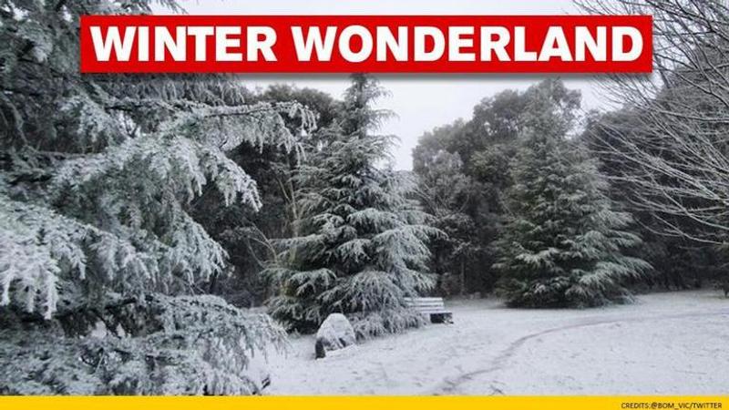
Thousands of people flooded social media with images and videos of various Australian states that witnessed the snowfall. Even the NSW Rural Fire Service department posted a ‘beautiful image’ of Clarence in the Blue Mountains on Saturday. The Bureau even posted a short video of snowmaking breathtaking scenes at Mount Macedon and said that such conditions are expected to ‘hang around’ for some time.
A beautiful image captured by @nampix at Clarence in the Blue Mountains this morning as snow settles across the Gospers Fireground.
— NSW RFS (@NSWRFS) August 21, 2020
It’s going to be a cold and windy day so rug up and ensure that you keep anything flammable at least a metre from the heater. #nswrfs #winter #snow pic.twitter.com/2SOtgusQLx
From my M-I-L's garden in #CentralWestNSW #snow ❄🌨🥶❄🌨🥶 That's the back porch just outside the living room. pic.twitter.com/BqnlQGlvhM
— Dr Scott Rickard (@Rickard_Scott) August 22, 2020
Heavy snowfalls in Oberon overnight and this morning. #snow pic @nampix for @smh and @9NewsSyd pic.twitter.com/U0GFgJJI8f
— Nick Moir (@nampix) August 22, 2020
Australia' multi-day-super-snow-storm totals keep growing. After another 25cm (10") overnight @PerisherResort and @ThredboResort (pictured) have 65cm (26") storm totals so far, @charlottepass is on 80cm (32"). pic.twitter.com/jKobKzxrfL
— Snow Forecast.com (@SnowForecast) August 22, 2020
#Snow has made for some beautiful scenes at #MtMacedon this morning. ❄️ These wintry conditions are set to hang around for #Vic and #NSW all weekend. Is there more snow on the way for you? You can find out by using https://t.co/CX9zhCmju3. pic.twitter.com/gmuicINPyM
— Bureau of Meteorology, Australia (@BOM_au) August 21, 2020
Sooooo excited!! It’s snowing at home. Never said that 12 months ago...... while living in the Kimberley.... currently 37 degrees in #Broome #snowyvalleys #tumbarumba #comevisitus #covidsafetravel #snow pic.twitter.com/sNMnL1Niii
— Catherine Marriott (@roseycatherine) August 22, 2020
So pretty!#Snow #Canberra pic.twitter.com/1V0UWy5Jta
— Prof Jodie Bradby (@JodieBradby) August 22, 2020
#snow this morning on the magnificent #Brindabellas #Canberra pic.twitter.com/wuNNXInXwu
— Daniela Stehlik (@RubaSkala) August 22, 2020
(Image credit: @BOM_Vic/Twitter)
06:30 IST, August 23rd 2020


