Advertisement
Updated March 28th 2025, 16:10 IST
Myanmar Earthquake: Over 200 Seismic Events in Three Months. Why the Region Remains Vulnerable to Deadly Quakes
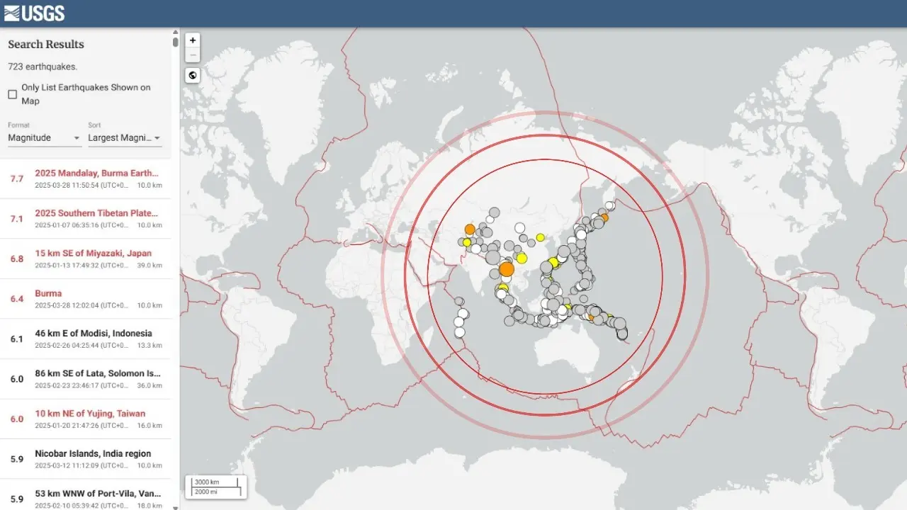
Myanmar Earthquake: Between Jan 2025 and March 28, 2025, the South and Southeast Asia region experienced over 200 earthquakes of magnitude greater than 4.0.
Myanmar Earthquake: On March 28, a powerful 7.7-magnitude earthquake struck Myanmar, sending tremors that were felt across several neighboring countries, including Thailand and Vietnam. The epicenter of the quake was located at coordinates 96.07°E, 21.93°N, near the Sagaing region in central Myanmar, at a depth of 10 kilometers.
The tremors were so intense that they reached as far as Bangkok, where residents experienced strong shaking. The Thai government quickly responded, declaring a state of emergency in the capital city to manage the chaos in the streets.
This earthquake is just one of many to strike the region over the past three months, underscoring the vulnerability of South and Southeast Asia to frequent seismic activity.
200+ Earthquakes in Three Months: A Region on High Alert
Between January 2025 and March 28, 2025, the South and Southeast Asia region experienced over 200 earthquakes of magnitude greater than 4.0, according to data from the United States Geological Survey (USGS).

The USGS, an agency within the U.S. Department of the Interior that studies Earth systems and natural hazards, reported numerous significant seismic events, particularly in areas like Myanmar, Indonesia, and the Philippines.
These earthquakes serve as a stark reminder of the region's susceptibility to seismic activity, with many of these events concentrated along fault lines and tectonic boundaries that are prone to frequent shifting.
Myanmar’s Seismic Vulnerability
The 7.7-magnitude earthquake speaks a lot about Myanmar's vulnerability to earthquakes, particularly due to its location along the Sagaing Fault.
This major tectonic boundary lies between the Indian Plate and the Burma microplate and runs approximately 1,200 kilometers through the country.
The Sagaing Fault has a long history of seismic activity, with significant earthquakes occurring at regular intervals.
In fact, the fault is notorious for its violent history, having been the source of several major earthquakes, including a magnitude 7.7 event in 1946 and a 6.8 quake in 2012. The fault is a strike-slip fault, meaning the two landmasses on either side of the fault slide horizontally past each other. Studies show that the fault is shifting at a rate of 11 mm to 18 mm per year, which results in the buildup of stress that, when released, triggers powerful earthquakes.
The Sagaing Fault's continuous movement means that more energy is being stored beneath the surface, creating the potential for even stronger earthquakes in the future.
The slip rate of up to 18 mm per year indicates significant tectonic movement, leading to the buildup of stress. When this stress is eventually released, the result can be a devastating earthquake.
Published March 28th 2025, 16:10 IST