Updated 20 May 2020 at 22:04 IST
MEA disapproves of Nepal's new map, urges India's territorial integrity to be respected
Reacting to Nepal incorporating parts of Indian territory in its official map on Wednesday, the Ministry of External Affairs slammed this "unilateral act".
- World News
- 3 min read

Reacting to Nepal incorporating parts of Indian territory in its official map on Wednesday, the Ministry of External Affairs slammed this "unilateral act". Maintaining that this move was not based on historical facts and evidence, MEA official spokesperson Anurag Srivastava observed that this was contrary to the understanding between the two countries to resolve boundary disputes through dialogue. He made it clear that India shall not accept such an "artificial enlargement" of territory. Thereafter, he urged the Nepal government to respect India's consistent position on this matter. Srivastava expressed hope that the Nepalese leadership would create a positive dialogue to resolve boundary issues.
Here is the MEA spokesperson's statement:
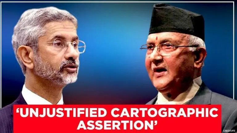
"The Government of Nepal has released a revised official map of Nepal today that includes parts of Indian territory. This unilateral act is not based on historical facts and evidence. It is contrary to the bilateral understanding to resolve the outstanding boundary issues through diplomatic dialogue. Such artificial enlargement of territorial claims will not be accepted by India. Nepal is well aware of India’s consistent position on this matter and we urge the Government of Nepal to refrain from such unjustified cartographic assertion and respect India’s sovereignty and territorial integrity. We hope that the Nepalese leadership will create a positive atmosphere for diplomatic dialogue to resolve the outstanding boundary issues."
Advertisement
Nepal vows to reclaim territories
On Monday, Nepal PM KP Sharma Oli chaired a Cabinet meeting in which the new map of the country featuring the Indian territories of Kalapani, Lipulekh, and Limpiyadhura was approved. Earlier in the day, Nepal Land Reforms Minister Padma Aryal unveiled the aforesaid political and administrative map of the country. Mentioning that the new map had been updated in the Constitution and will be kept at government offices, he promised that requisite legislation would be tabled in the Parliament.
Moreover, he exuded confidence that India would positively consider the issue. Addressing the Parliament on May 19, the Nepal PM claimed that India had made Kalapani, Lipulekh, and Limpiyadhura "disputed" by stationing its Army there. He vowed to reclaim these territories from India through diplomatic efforts.
Advertisement
As per reports, Nepal's new map has been drawn on the basis of the Sugauli Treaty of 1816 signed between Nepal and the then British Indian government and other relevant documents. The row originally started when India issued a map in October 2019 incorporating Kalapani and Lipulekh on its side of the border. In May 2020, Defence Minister Rajnath Singh inaugurated an 80-km strategically crucial road connecting the Lipulekh pass with Dharchula in Uttarakhand. This will serve as a link road to Kailash Mansarovar in Tibet. Nepal had raised serious objections to the inauguration of this road.
Published By : Akhil Oka
Published On: 20 May 2020 at 22:04 IST
