Published 11:56 IST, June 29th 2020
Satellite images show parts of Australia recovering from drought and bushfires
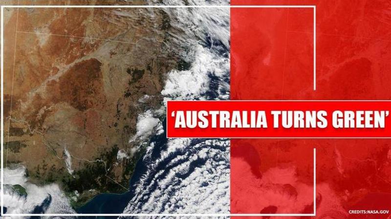
NASA's recent satellite images show how the environment is bouncing back in the Southeastern part of Australia and how the land is starting to look greener.

From deadly bushfires to drought, Australia battled some brutal conditions over the past few years which left the country’s southeast side looking like a dry, barren, scorched place. However, NASA Earth Observatory’s recent satellite images show how the environment is bouncing back in the Southeastern part of Australia and how the land is starting to look greener. NASA shared a series of satellite images. While one photo showed how the Australian land looked back in 2018, another image was taken recently which showed ‘progress’ and greener land.
According to the official NASA Earth Observatory website, From January 2017 through October 2019, the southeast Australian state experienced its lowest amount of rainfall in nearly a century. During that time, farmlands were parched, lakes dried up, and millions of fish died”.
The Earth Observatory further informed, “After more than 34 consecutive months of dry conditions, steady and occasionally heavy rain finally arrived in New South Wales. From January to May 2020, southeastern Australia received above-average rainfall and even broke records in Victoria”.
According to an international media outlet, records were broken in Victoria as it experienced the biggest rainfall the city had copped since 1924. The Australian Bureau of Meteorology also reported that April and May of this year was the first time in four years that there was close to average rainfall in New South Wales and the Murray-Darling Basin. With reviving nature, there are also predictions that for the next two months, the country might experience more rain than the average.
Storage levels still ‘very low’
Even though the Australian land is getting greener, NASA said that the rains did not hit all the right places. According to the space agency, water ‘storage levels are still very low’. The Bureau of Meteorology also reportedly reckoned that it will take several massive rainfall events for the drought to be broken.
NASA said, “The wet start to 2020 has alleviated short-term water deficiencies in eastern Australia and helped provide a better start to the winter farming season. However, the rainfall has not yet compensated for the effects of the long-term drought, which is still evident in the Murray-Darling Basin”.
They further added, “The BOM stated that it will take several significant rainfall events to erase the long-term rain deficiencies across the region”.
(Images credit: NASA Earth Observatory/Website)
Updated 11:56 IST, June 29th 2020


