Published 07:54 IST, September 7th 2021
Hurricane Larry replaces Ida, 'intensifying again' in major warning to US
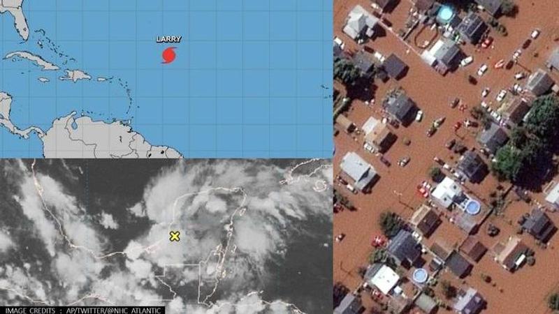
While Ida made catastrophic hit on Northeast Corridor, Hurricane Larry which will intensify Wednesday night could even be stronger, weather forecasters predict.

Advertisement
As the United States reels under the aftermath of the dangerous category 4 Hurricane Ida that barrelled along 1,000 miles stateside wreaking destruction to human lives and property, ravaging Louisiana with powerful winds that sustained 150 mph speed, a new hurricane ‘Larry’ is now brewing. Forecasters at the National Hurricane Centre (NHC), a division of the US National Oceanic and Atmospheric Administration (NOAA) said Monday that a dramatic low-pressure area in the western Caribbean was building up which is expected to conjure a deadly storm that will sweep through the Gulf of Mexico then move across northern Florida before emerging over the Atlantic.
The category 3 storm located south of Cape Verde Islands would strengthen into a major hurricane overnight Saturday, weather forecasters predicted. “Dangerous surf and rip currents are expected later this week along the eastern United States coast,” warned the National Hurricane Center. While Ida made a catastrophic hit on the Northeast Corridor, tropical Storm Larry, which will intensify into a hurricane Wednesday night could even be stronger than Ida as it will hit the East with a 'life-threatening' surf worsening the trail of destruction, Accuweather meteorologists warn.
Here are the 5 PM AST Mon, Sep 6 Key Messages for Hurricane #Larry. Interests in Bermuda should continue monitoring the latest forecast updates. Dangerous surf and rip currents are expected later this week along the eastern United States coast.
— National Hurricane Center (@NHC_Atlantic) September 6, 2021
Latest:https://t.co/oLAjv1lKWp pic.twitter.com/8GAF7mwUdc
[Credit: National Hurricane Center]
[Credit: National Hurricane Center]
Ida had recorded powerful winds of 130 to 156 mph, making a landslide in Louisiana and bringing torrential downpours across several states including New York, but if winds for Larry spiral above 150 mph, it will be the deadliest and strongest hurricane in the Atlantic of 2021, the weather service stated in a broadcast. It will churn across the Atlantic eventually barrelling into Bermuda close to North America, according to Accuweather. The eastern US coast would start to experience impact as soon as midweek, Wednesday, and the storm that will swell into a large hurricane is "likely to cause life-threatening surf and rip current conditions," the National Hurricane Center cautioned.
Hurricane #Larry Advisory 25: Noaa Aircraft Finds Larry Slightly Stronger. Expected to Cause Dangerous Surf and Rip Currents Along Western Atlantic Shores Later This Week. https://t.co/VqHn0u1vgc
— National Hurricane Center (@NHC_Atlantic) September 6, 2021
"Little change in strength is forecast during the next few days, although fluctuations in intensity will be possible. Larry is expected to remain a major hurricane through the middle of this week,” forecasters at National Hurricane Center warned on Sep. 6.
The storm originated 830 miles east of the Northern Leeward Islands on Sunday afternoon, and at the time had a wind speed of 13 mph. It eventually picked up higher gusts at 125 mph as the hurricane-force winds extended outwards up to 45 miles from the center and tropical-storm-force winds extended outward up to 175 miles, the center said. As it evolves into a powerful hurricane, the Category 4 storm will hit along the Jersey Shore and other parts of the East Coast in the US. The beachgoers were once again put on high alert for dangerous rip currents this week. “These currents can be especially dangerous to bathers that may get caught up in the flow of water,” AccuWeather noted in a broadcast. “Even though rip currents are always there in average wave conditions, the stronger and more frequent the wave action, the stronger and more frequent the rip currents tend to become."
Here is Hurricane Larry from @Space_Station yesterday. Hoping this one doesn’t make landfall. pic.twitter.com/I0PwrX858v
— Megan McArthur (@Astro_Megan) September 5, 2021
IMAGE: AP
07:54 IST, September 7th 2021


